
Arapahoe County ZIP Code Evidence by Area
The verified local evidence below combines county address examples with the City of Aurora ZIP polygon data. It is deliberately grouped where the research found the same municipal or boundary pattern. The post-office column does not name stations because the complete USPS post-office, PO-box, and unique-ZIP matrix was not obtained.
| ZIP | Areas Covered | Post Office | Notes |
|---|---|---|---|
| 80010, 80011, 80012, 80013, 80014, 80015, 80016, 80017, 80018, 80019, 80045 | Aurora and east-metro areas | USPS station not obtained; verify | Aurora GIS values; 80045 has a medical or campus-area clue, but unique-ZIP status was not confirmed |
| 80102 | Bennett | USPS station not obtained; verify | Municipal and county boundary check required |
| 80103 | Byers | USPS station not obtained; verify | Local postal example, not a full station inventory |
| 80105 | Deer Trail | USPS station not obtained; verify | Local postal example near the county’s eastern edge |
| 80110 | Englewood and Sheridan | USPS station not obtained; verify | One ZIP was observed with two municipal names |
| 80111, 80112, 80121 | Centennial, Greenwood Village, and Englewood area | USPS station not obtained; verify | Postal and municipal names can diverge |
| 80113 | Englewood and Cherry Hills Village | USPS station not obtained; verify | Two local municipal associations were observed |
| 80120, 80123, 80126 | Littleton, Columbine Valley, and surrounding metro area | USPS station not obtained; verify | Some service area can extend beyond Arapahoe County |
| 80136 | Strasburg | USPS station not obtained; verify | Census-community and ZIP route; county edge needs checking |
| 80137 | Watkins and east metro | USPS station not obtained; verify | Aurora GIS boundary value; USPS delivery route still needed |
| 80220, 80230, 80231, 80237, 80238, 80239, 80246, 80247, 80249 | Denver, Glendale, Four Square Mile, and Aurora boundary region | USPS station not obtained; verify | Denver postal names may serve Arapahoe parcels |
These local examples are not an exhaustive Arapahoe County ZIP code directory. A complete post-office, PO-box-only, unique-ZIP, and station matrix was not obtained from USPS during the research capture. Use the ZIP as a delivery clue, then confirm the parcel and responsible jurisdiction.
Note: The table records local evidence and research gaps; it is not a complete USPS station or PO-box inventory.
Arapahoe County ZIP Code Search Fields
Only the voter lookup in the captured sources uses a ZIP as an identity field. It does not browse every person in a ZIP. The search requires a first name, last name, date of birth, and residential ZIP, then returns only the public fields allowed by Colorado election rules.
| First Name | Required text field for the person match |
|---|---|
| Last Name | Required text field; exact spelling can affect the match |
| Date of Birth | Required date used for identity matching; full DOB is not a public voter-file field |
| Residential ZIP | Required five-digit ZIP for the residential address |
| Find My Registration | Submit control for the current registration lookup |
GoVoteColorado can return a mailing address, precinct or district information, party affiliation, and county clerk contact, subject to protected status. The Assessor and Treasurer forms do not show a ZIP-only field. They use street number and name, range, unit, AIN, or PIN, after which the parcel card may show situs and mailing ZIP fields.
Find Arapahoe County Residents by ZIP
A ZIP-keyed resident search should move from delivery geography to a person or parcel question. The county’s Basic Voter List and custom list routes can provide permitted public names, addresses, status, districts, and history, but their documented filters are precinct, district, party, status, and history rather than a simple ZIP browse.
- Confirm the delivery ZIP with the USPS ZIP Lookup for the exact address, city, and state. The USPS result route is the postal authority for the address, not the county parcel boundary.
- When a person is known, run the voter lookup with first name, last name, DOB, and residential ZIP. Record the public return fields and the lookup date, while recognizing that protected, inactive, cancelled, or unregistered records may not match.
- For a county voter file, ask Elections for the exact precinct or district, party, status, history interval, and delivery format. Basic downloads are no-cost; custom lists are documented at $25 for comma-delimited text or $35 for Excel, with printed copies at $0.25 per page.
- For parcels, use GIS Location Info or ArapaMAP first, then the Assessor or Treasurer address search. A ZIP-wide property search is not a visible feature in those portals.
Once a ZIP narrows the area to a street or address range, continue with the Arapahoe County street directory route, where the address and parcel keys can be inspected one at a time.
Note: A ZIP search narrows delivery geography, but it does not create a ZIP-wide public resident list.
Aurora’s Arapahoe County ZIP Polygon Clues
The official Aurora ZIP GIS layer is a useful local geometry source. Its field is named ZIP_CODE_ID, with the alias ZIP_CODE, and the service supports map queries. It returned Aurora-area values that include the 800-series, 801-series, and boundary-region ZIPs listed above.
This is City of Aurora data, not a countywide USPS source. It can show where a polygon falls in Aurora’s map system, but it does not establish a post-office assignment, a unique-ZIP status, or the occupants of a parcel. Pair it with county parcel jurisdiction and USPS delivery verification.
Arapahoe County ZIP Checks Through Location Info
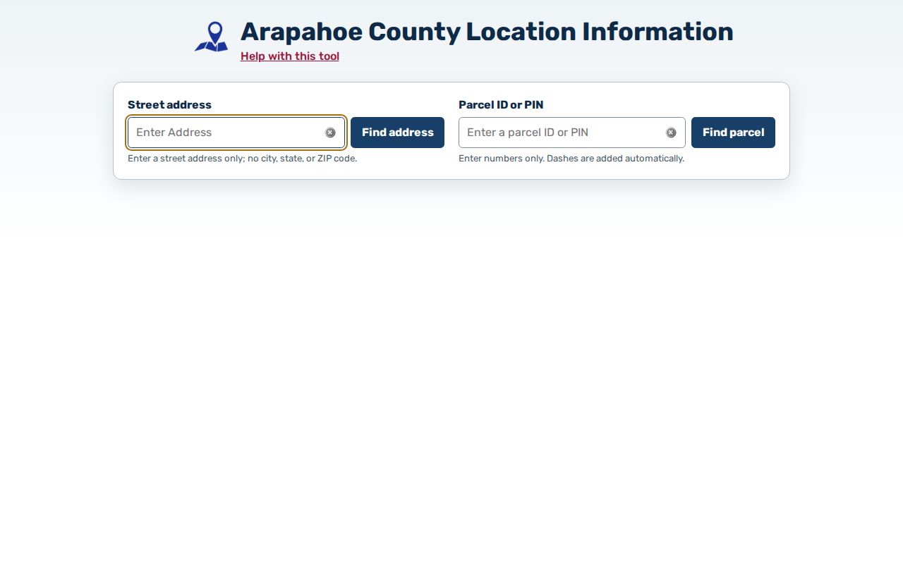
County GIS Location Info accepts a street address without adding city, state, or ZIP, or it accepts a parcel ID. The returned parcel centroid supplies jurisdiction, districts, and related location data. That makes it a useful check when a ZIP name and a city name point to different records paths.
The Arapahoe County Location Info tool is the source shown in the image below.
Multiple-situs parcels can return only the first or a random address. Open the parcel card, test address alternatives, and compare the legal description before routing a permit, tax, or public-record request to a city or county office.
Arapahoe County ZIP Boundaries and City Lines
A ZIP code is a delivery geography, while a city or county boundary is a legal and administrative geography. Aurora, Bennett, and Littleton cross county boundaries. Four Square Mile is a distinct local clue, roughly described in the county HOA form around Mississippi and Yale to Dayton and Quebec, with both Denver City and County and City of Aurora options.
- ZIP versus ZIP+4
- A ZIP is the five-digit delivery area. ZIP+4 adds a smaller delivery segment and does not create a parcel or city boundary.
- PO-box ZIP
- A postal code assigned to boxes at a post office; it may differ from the code used for street delivery.
- Unique ZIP
- A code assigned to one institution or large address rather than a normal neighborhood route. Its status must be confirmed with USPS.
- Carrier route
- A delivery sequence inside a ZIP. It is not a public resident list or a legal neighborhood line.
Boundary and lawful-use check. Use the ZIP for delivery matching and a lawful, specific records question, then use the parcel centroid and jurisdiction result to choose the office. A postal city is not proof that the parcel sits inside that city or inside county custody. Do not combine delivery and parcel clues to stalk, harass, or intimidate anyone.
The same address can therefore carry a postal label, a municipal jurisdiction, a county parcel record, and a different historical street label. Preserve each string when tracing a resident or a former address.
Note: Parcel jurisdiction decides the records office when a postal city and a municipality disagree, even when the delivery label names another city.
Arapahoe County ZIP Geography Across Thirteen Municipalities
Arapahoe County covers approximately 805 square miles, has more than 650,000 residents on the county’s current About page, and includes 13 incorporated cities and towns along with unincorporated communities and special districts. The geography moves from dense Aurora to Centennial, Englewood, Greenwood Village, and Littleton, then outward to Bennett, Byers, Deer Trail, Strasburg, and Watkins-area routes.
That scale explains why a ZIP code directory cannot be reduced to one post office or one records desk. A ZIP can cross municipal names, and a municipality can cross county lines. Four Square Mile adds a Denver and Aurora jurisdiction clue. Use the local area labels in the table as search prompts, not as a promise that every parcel in a ZIP shares one custodian.
The Missing Arapahoe County ZIP Matrix
The research capture did not obtain a complete USPS matrix showing every ZIP serving Arapahoe County, each post office, PO-box-only code, unique ZIP, or station assignment. The USPS lookup returned an access error during capture. That gap is stated here because an invented station name would misroute a request and blur postal geography with parcel jurisdiction.
When the official matrix is needed, use USPS for the exact address, County GIS or ArapaMAP for the parcel and jurisdiction, and the Assessor or Treasurer for the parcel record. Mapping questions can go to GIS/Mapping at 720-874-6686; Assessor questions to 303-795-4600; Planning to 720-874-6650; and Zoning to 720-874-6711.
For a county-held address-point history, readdressing file, map layer, or ZIP and jurisdiction crosswalk that is not online, use a targeted Colorado Open Records Act request to the responsible custodian. DPL street guides, XL directories, Littleton and Aurora history collections, and Sanborn maps can help with old address strings, but they do not replace the current USPS check.
Written and in-person follow-up matters when an address has several situs entries or a city and ZIP disagree. Ask GIS or Planning to identify the parcel and jurisdiction, ask Assessor or Treasurer staff which parcel key to use, and ask USPS to confirm delivery geography. Keep the postal label, parcel ID, legal description, municipality, and request date together so a later resident or records search does not collapse them into one unverified location.
Note: Preserve the postal label and parcel jurisdiction as separate fields when a future request depends on either one.